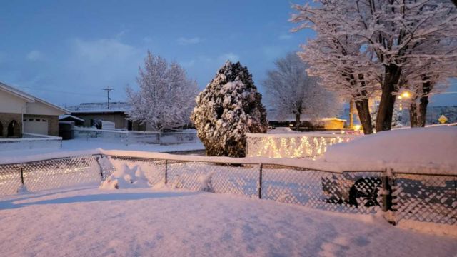
The rest of the week will have active weather starting on Tuesday. Parts of New Mexico may have heavy snowfall again tonight, and the rest of the weekend will bring more snow and rain.
All of New Mexico is now covered with clouds as of Tuesday. The temperature is marginally lower now than it was on Monday due to clouds. Though most of it is evaporating before it reaches the ground, rain and mountain snow are starting to spread into the state’s western and northern regions. As we get closer to the overnight, this will alter. Starting early on Wednesday, a cold front is expected to move over the state from west to east. As this cold front passes over the state, the heaviest snow and rain will fall directly behind it and along its path. Behind the front, there will also be wind. In many places, the gusts will reach over 30 mph, but in southern and eastern New Mexico, they may reach up to 55 mph. Through Wednesday night, there will be sporadic bouts of rain and snow, which will end on Thursday. For the areas of southern Colorado and New Mexico that will receive the most snowfall—up to 14 inches in the northern mountains and 36 inches in the San Juan Mountains—Winter Storm Warnings and Weather Advisories go into place tonight. These conditions will last through Thursday.
Through Friday, a number of mild weather disturbances will continue to provide sporadic rain and snow showers in western, northern, and central New Mexico. The northern highlands and southern Colorado will experience brief periods of moderate to heavy snowfall. The remainder of the week could see lower temperatures as well; by Friday morning, snow levels might drop as low as 5,500 feet.
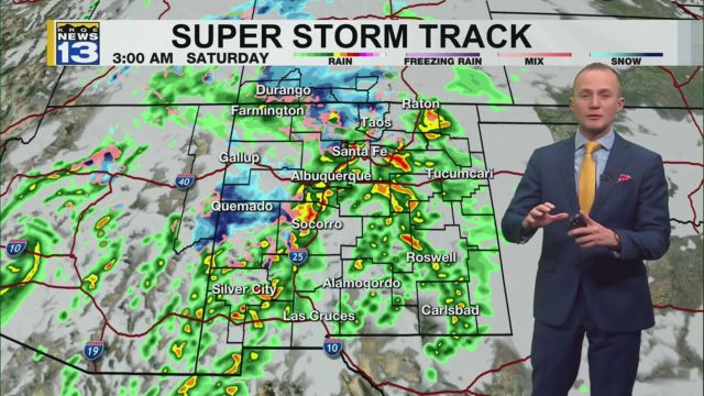
On Saturday, a heavier storm approaches, but there is still some uncertainty surrounding it. Strong low pressure is expected to enter New Mexico on Saturday, bringing with it cooler temperatures and snowfall as low as possible to the valley bottoms and even into the eastern plains, according to forecast models. It is a forecast to absolutely keep an eye on, albeit there is a lot of uncertainty about exactly where and how much snow will fall outside of the mountains.
By Sunday afternoon, the quieter weather is back, and early next week, the warmer weather is back.